This 33-leg adventure will take you to the most beautiful and remote locations in the Idaho backcountry, all while navigating dynamic weather and challenging landing strips. From Boise to British Columbia, Canada, this 1,400 mile Idaho Bush Trip will get your adrenaline flowing while showing you why Idaho is regarded as the best state for bush trip flying in the United States.
There are 2 ways to enjoy this custom 33-leg bush trip on your own schedule. Play either directly through the Microsoft Flight Simulator Bush Trip menu, or in Free Flight, using the instructions I provide below.
Option 1: Play these bush trips as an in-game experience, just like the bush trips that came with the game. Your progress will be auto saved and you will have the directions, distance, and ETE embedded in the on screen NavLog as well as access to the ‘back on track’ feature. You can fly whichever plane you like and I have added the ability to adjust date, time and weather, something you could not do in the original bush trips. Additionally, our in-game experience uses the SoFly weather presets for more realistic and visually dynamic weather.
For today only and only valid for our Facebook fans, save 10% off of the full price of the bundle by using the link below and the coupon code FBHalloween. Offer expires 11/1/2020 at 11:59PM PST. See for yourself why this Idaho bush trip has received nothing but 5-star reviews from the Community.


Option 2: Simply input the data I provide in the Central Idaho Bush Trip and the North Idaho Bush Trip into your Microsoft Flight Simulator 2020 world map. Please be sure to input the desired date, time, and weather for all of the legs. I suggest you begin with the Central Idaho Bush Trip. When combined with the North Idaho trip afterwards, this will be the beginning of a 33-leg, 1,400nm adventure that will take you from the Idaho state capital of Boise to British Columbia, Canada.
Below is a collection of some of my favorite legs if you just want to get your wings in the air for a quick adventure in Idaho.
Central Idaho Leg 14: Smiley Creek (U87) to Twin Bridges (U61)
Set Date, Time and Weather to April 10th 2020 7:00AM
Weather Preset Pro – Snow Flury
In Game Preset – Snow (More detailed weather settings located in the Premium Version

You wake up from a frigid night camping to find snow covering the ground and snow flurries in the peaks in the Pioneer Mountains, todays flight destination. Take off from Smiley Creek and follow Highway 75 south before it turns to the east and begins climbing. Find the horseshoe shaped bend in the road that backs up to the mountains on the Galena Pass.
Head straight east, climbing to tackle the tall peaks of the mountains for almost 19nm until you reach an unnamed sharp peak that stands out against the rounded mountains that surround it.
Turn hard south for just over a mile until you reach an unnamed lake that sits unexplored in this remote mountainous terrain.
From the lake, you should be able to see the 12,008 Hyndman Peak, 9nm to your south. While Hyndman Peak sits in the middle of many other peaks that attempt to rival its height, there is only one true King in the Pioneer Mountains.
From Hyndman Peak, follow the tall ridgeline of jagged, remote peaks. First south, than east, than north, this crescent shaped turn explores some of the most beautiful, and remote, locations in all of the United States. On your north swing of the crescent, look for a ridgeline that turns sharply back to the east.
Follow this ridgeline to Standhope Peak, easily identified by the 3 alpine lakes, Goat, Betty and Baptie, that sit just below its peak to the southeast.
Continue to follow this ridgeline northeast for another 2nm until you reach Pyramid Peak.
Turn further north along the ridge as it begins to descend and look for Big Black Dome in 2nm.
Continue your descent northwest until you reach the Big Lost River East Fork.
Look for the snow covered Twin Bridges airstrip in just under 3nm. The long strip lies just beyond the split where the Big Lost River splits into the North and East Fork.
| Heading | Distance | ETE |
| 86 – Galena Peak | 4.99 NM | 2’22” |
| 76 – Unnamed Peak | 18.54 NM | 8’49” |
| 154 – Unnamed Lake | 1.35 NM | 0’38” |
| 132 – Hyndman Peak | 9.04 NM | 4’18” |
| 63 – Ridgeline East | 3.48 NM | 1’39” |
| 28 – Standhope Peak | 1.80 NM | 0’51” |
| 52 – Pyramid Peak | 1.62 NM | 0’46” |
| 004 – Big Black Dome | 1.67 NM | 0’47” |
| 303 – Big Lost River East Fork | 6.55 NM | 3’7″ |
| 322 – Twin Bridges | 2.78 NM | 1’19” |


Central Idaho Leg 6: New Meadows (1U4) to Big Bar (ID42)
Set Date, Time and Weather to April 6th 2020 6:00PM
Weather Preset Pro – Scattered Storms
In Game Preset -Storm (More detailed weather settings located in the Premium Version)

In true Idaho Spring tradition, a severe thunderstorm has rolled in from the west, coming directly over the Seven Devils Mountain Range, which, unfortunately for your motion sickness prone girlfriend, is right in the middle of your flight plan to Big Bar, a small landing strip on the mighty Snake River. But you have a schedule to keep, and you will be damned to let a little thunderstorm stop you from arriving at your Snake River campsite. Take off from New Meadows and head west until you hit the northern edge of Lost Valley Lake,
Turn northwest and beginning the big climb up to the Seven Devils. At the very top of the range, look for a valley that carves through the peaks. In this valley you will find the remote Emerald Lake.
From Emerald Lake, follow the canyon at the top of Seven Devil’s until the V shaped exit leads you down north to the Snake River.
Follow the river northeast for 15 nautical miles until you reach Big Bar landing strip. You may think it’s the longer, bigger strip with the long gray building at the far end, but it is actually the small
strip across the river. One small building sits on the side of the strip. A challenging landing in clear skies, the thunderstorm and high winds leave no room for error. Once you land, revel in the excitement that this treacherous journey brought and set up camp and watch the thunderstorm slowly move east until clear skies lead to a night sky full of stars.
| Heading | Distance | ETE |
| 249 – Lost Valley Lake | 7.58NM | 5’00” |
| 328 -Seven Devils Mountains (Emerald Lake) | 21.24NM | 13’00” |
| 308 -Snake River | 7.38NM | 5’00” |
| 9 – Big Bar | 14.73NM | 9’00” |


North Idaho Leg 4 : Running Creek Ranch (05ID) to Boulanger Field (4MT9)

Set Date, Time and Weather to June 6th 2020 9:20PM/Clear Skies
After an afternoon exploring the remote Selway River, you are excited to head towards the famed Selway-Bitterroot Wilderness. The Idaho/Montana border cuts right through this remote area, and your flight path will take you over the state line. With a full moon rising, you decide to take off shortly before sunset, hoping to catch the moonrise as you approach El Capitan.
Upon takeoff, head northeast until you reach Cub Lake.
Turn slightly east and over the ridge you will find Lake Captain.
From Lake Capitan, turn slightly north again. You should see El Capitan and the moonrise out of your right side window. Any photos at this point will be great, but my favorite angle is 1.5nm into this subleg, just northwest of an unnamed lake. Position your plane a good distance from El Capitan as you approach It is time to get that drone camera out! The longer the focal length (zoom) of your camera, the bigger the moon will appear, so make sure to set the zoom between 80-100 to get the dramatic shot you are after.
Once you have your images worthy of hanging in an art gallery, turn southeast and continue onto a close up view of El Capitan.
From El Capitan, head northeast to passing a number of smaller lakes until you reach the large Lake Como, a favorite recreation area for locals from both Montana and Idaho. Cross the lake until you reach the eastern shoreline.
Once you hit land, turn slightly north until you reach US93 where it bends alongside the Bitterroot River.
From the bend in the road, turn straight south and begin your approach to Boulanger Field. The small landing strip will be an interesting landing, since it doesn’t have lights and will just appear as a black spot of darkness in the middle of the town of Darby, Montana. Look for the soccer field to the west of US93 and the dark void before it is your target. The runway runs north/south, so approach heading directly south. After a successful landing, you may need to change the time to daylight to find the runway, as sometimes the trigger to end the leg requires you to come to a stop on the actual landing strip.

| Heading | Distance | ETE |
| 53 – Cub Lake | 15.10 NM | 7’6″ |
| 63 – Lake Capitan | 1.65 NM | 0’48” |
| 56 – Moonrise Photo Location | 1.46 NM | 0’42” |
| 110 – El Capitan | 1.57 NM | 0’51” |
| 48 – Lake Como | 7.50 NM | 3’34” |
| 30 – US93/Bitterroot River | 2.90 NM | 1’18” |
| 164 – Boulanger Field (4MT9) | 4.26 NM | 3’20” |


North Idaho Leg 5 : Boulanger Field (4MT9) to Brier Patch (4MT8)

Set Date, Time and Weather to June 7th 2020 5:35AM
Weather Preset Pro – Big And Bold
In Game Preset -Broken Clouds
You wake up early to thick broken clouds covering the Selway-Bitterroot Wilderness, whose high mountain peaks serves as your destination for this sunrise flight. Taking off from Running Creek Ranch can be challenging, as you will barely clear the houses that sit at the southern end of the strip. Once airborne, head northwest back to Lake Como, the body of water you flew over last night as darkness descended on western Montana.
Once you reach the lake, head due west past the lake and into the canyon which is sandwiched between El Capitan on the south and Whites Mountain on the north. At the end of the canyon, look for Elk Lake, sitting between to forks of Rock Creek.
From Elk’s Lake turn southwest for just 2nm until you reach Big Grizzly Lake which connect to Little Grizzly Lake and Milepost Lake. At this point, and for the rest of your flight through the mountains ahead, you will straddle the Montana and Idaho border, often going back and forth between the two states.
Turn hard to the northeast and begin your frigid, high altitude flight through the Bitterroot Mountain Range, a large part of the Selway-Bitterrot Wilderness Area. The entire protected wilderness is 1.3 million acres making it the third largest in the United States, excluding Alaska. The Frank Church-River of No Return Wilderness Area is directly to its south, and only the Magruder Corridor, a rigged dirt road, separates the two. Together, the two wilderness areas consist of a mind-boggling five million acres. Follow the endless chains of remote alpine lakes that sit between stunning mountain peaks for 28nm until you reach Big Creek Lake, which shape resembles a Par 5 dog leg golf hole, where the far edge of the lake crunches up against a cliff which leads down a valley going eastward.
Slowly descend the valley towards populated, flat farmland and the Biterroot River.
Follow the Bitterroot River for 4 miles until you reach the town of Stevensville.
Turn southeast and begin your approach to the Brier Patch airstrip, a grass strip that sits next too a building. Pass the airstrip and make your final approach on runway 30 facing northwest so you can enjoy the view of the Bitterroot Mountains as you touch down.

| Heading | Distance | ETE |
| 277 – Lake Como | 3.65 NM | 1’33” |
| 255- Elk Lake | 7.45 NM | 3’12” |
| 228 – Big Grizzly Lake | 2.04 NM | 0’53” |
| 356 – Big Creek Lake | 28.07 NM | 13’1″ |
| 11- Bass Lake | 6.54 NM | 3’11” |
| 85- Bitterroot River | 8.43 NM | 4’36” |
| 173- Stevensville | 3.92 NM | 1’58” |
| 118 – Brier Patch (4MT8) | 2.74 NM | 2’17” |


North Idaho Leg 7 : Cayuse Creek (C64) to Big Island (ID29)

Set Date, Time and Weather to June 8th 2020 6:00AM
Weather Preset Pro – Dense Fog
In Game Preset -Overcast (More detailed weather settings located in the Premium Version
You wake up early in your tent alongside the rambling Cayuse Creek to a thick fog that hangs in the air on this crisp autumn morning. As the fog layer isn’t too thick at ground level, you decide that if you follow the extensive river system to Big Island, you shouldn’t have much difficulty.
Take off from Cayuse Creek heading northeast until you reach the intersection of the North Fork Clearwater River. With the thick morning fog, you will have to fly low, just over the rivers, so you don’t lose your way.
Follow the North Fork Clearwater River west for 7nm to the west until you see an intersection with the Kelly Fork of the river taking a hard 90 degree turn to the right. You will know it’s the right path when you see a campground on the shores to your north, next to the fork. This means you are on the right path, so keep following the original river westward.
Follow the winding river west for about 11nm, making sure to stay low to avoid getting lost in the fog. The river will abruptly turn northward.
Follow the northwest flight path for 6 miles until the river takes a turn to the east.
Follow the north east flight path for 7 miles until the river takes another sharp turn back to the west.
After about 20nm, you will reach another major river intersection, this time at the Little North Fork Clearwater River. The waterway going north to south is Dworshak Reservoir section of the Clearwater River and is considerably wider than the narrow waterways you have been following for the last 40+ miles.
Head south along the wide river until you see a noticeable triangle shape piece of land on the eastern shore. This piece of land separates the main river from an offshoot that turns into Little Silver Creek. Exit the river and fly over the triangle shaped land.
Follow the land parallel to the river until you see the Big Island landing strip, which should be easy to spot by the misplaced ATC tower jutting out of the forest.

| Heading | Distance | ETE |
| 20 – North Fork Clearwater River Intersection | 3.37 NM | 1’39” |
| 257- Kelly Fork Intersection | 9.49 NM | 4’5″ |
| 228 – North Fork Clearwater River | 11.16 NM | 4’46” |
| 319 – North Fork Clearwater River | 6.21 NM | 2’40” |
| 25- North Fork Clearwater River | 6.78 NM | 3’33” |
| 271- North Fork Clearwater River | 11.90 NM | 4’52” |
| 237- Little North Fork Clearwater River/Dworshak Reservoir | 7.53 NM | 3’10” |
| 191 – River Exit | 5.21 NM | 2’24” |
| 118 – Big Island (ID29) | 3.10 NM | 2’8″ |


North Idaho Leg 14: Craik (29MT) to Cx Ranch (ID01)

Set Date, Time and Weather to June 10th 2020 3:00AM.
Weather – Clear Skies
The afternoon storm has delayed your flight schedule, as you planned on watching the sunrise from the shores of Lake Pend Oreille. As the clouds clear as the night sets in, you decide a moonlit route up the Clark Fork river should be easy enough as the Cx Ranch landing strip is easy enough to find.
Take off from Craix and head east until you meet up with the Clark Fork River and head north until you reach Frampton airport, your half way mark to Lake Pend Oreille.
Continue northwest along the Clark Fork river. In the distance, the moon will be lighting up Lake Pend Oreille, easily making it visible. As you approach the wide opening of the lake, you will fly over the small town of Clark Fork on the east side of the river. Directly opposite, on the west bank of the Clark Fork River, you will see the Cx Ranch landing strip, illuminated by four lights, 3 of which lie on the west side of the runway.
| Heading | Distance | ETE |
| 308 – Frampton Airport | 17.76 NM | 7’52” |
| 284 – Cx Ranch (ID01) | 19.76 NM | 9’34” |


Central Idaho Leg 12: Upper Loon Creek (U72) to Stanley (2U7)
Set Date, Time and Weather to April 9th 2020 6:40AM
Weather Preset Pro –Big And Bold
In Game Preset -Scattered Clouds (More detailed weather settings located in the Premium Version

You heard a rumor that the town of Stanley, your next destination that lays at the base of the Sawtooth Mountains, is most photogenic at sunrise, so you decide on an early 6:40AM departure from Upper Loon Creek to catch the early morning light on the mountain peaks.
Taking off in the early morning, you will only have twilight to guide you to Stanley. Gaining altitude at this high elevation is tricky, so navigate through the lower notches in the mountains until you reach a safe altitude to turn to heading 147.
After at least 6 and a half minutes, you will see a road with street lights that guide you south. Follow the road until you come to Yankee fork, a Y in the road.
Turn south following the road until you reach the Salmon River at the small town of Sunbeam. Follow the river west which will lead you to Stanley and the stunning view of the Sawtooth mountains. The clouds should be changing color right about now, so why not set active pause right when you are approaching town and wait to watch the sunlight hit these glorious peaks. I hope this shows you why Stanley is my favorite place in all of Idaho.
| Heading | Distance | ETE |
| 147 – Yankee Fork | 13.00NM | 7’00” |
| 165 – Sunbeam | 7.00NM | 4’00” |
| 251 – Salmon River Continue | 6.00NM | 3’00” |
| 208 – Stanley | 5.00NM | 3’00” |

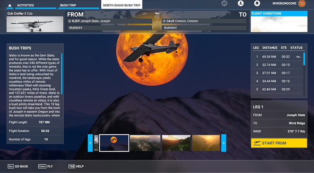
Leg 18: Boundary Co (65S) to Creston (CAJ3)

Set Date, Time and Weather to June 10th 2020 8:40PM
Weather Preset Pro – Big And Bold
In Game Preset – Broken Clouds (More detailed weather settings located in the Premium Version
I hope you didn’t forget your passport, because your final leg will take you just over the Idaho border and into British Columbia, Canada as a vibrant, explosive sunset bids you a fond farewell from Idaho. Take off from Boundary Co and fly west until you find the Kootenay River.
Fly north along the river for just about 10 minutes, as the colorful light bounce off of the river and bold clouds above. As soon as you cross the border into Canada, you will see the well lit Creston airport on the east side of the river. Once you stick the landing and turn off your bird, head to the nearest Tim Horton’s and get yourself a celebratory donut!

| Heading | Distance | ETE |
| 201 – Kootenay River | 2.31 NM | 1’7″ |
| 326 – Creston (CAJ3) | 21.54 NM | 10’46” |


Thank you for flying the Idaho backcountry with me! I hope you enjoyed your trip. Please sign up for my newsletter to be the first to know of my next bush trip release. And please feel free to contact me at with any questions or future bush trip suggestions.